Walking the Ngā Tapuwae o Toi Trail near Whakatāne is an opportunity to learn about Toitehuatahi (Toi) acknowledged as the principal ancestor of many North Island tribes, including Ngāti Awa.
The trail takes in Toi’s stronghold, Kapu-te-Rangi, one of the oldest pa sites in New Zealand.
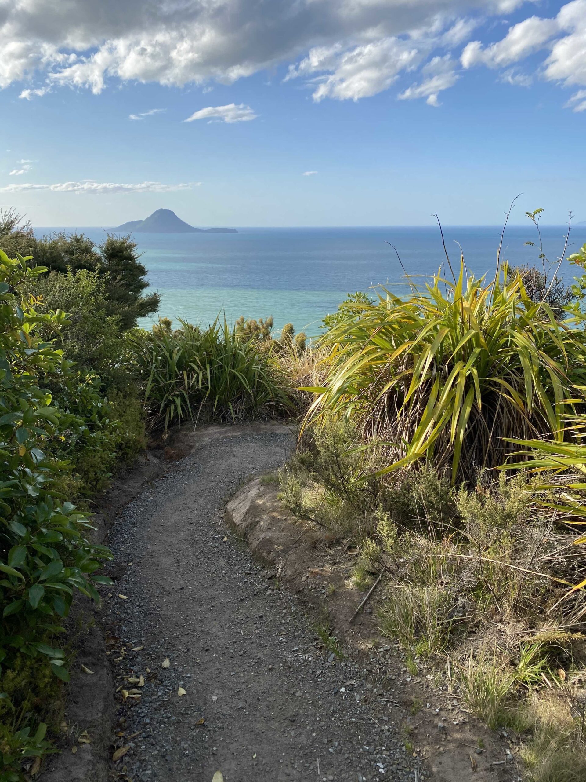
Hundreds of years earlier, Toi and his ancestors trod these trails and from high up on the vantage points the views across Whakatāne, the river and out to the harbour are immense.
You can walk the Ngā Tapuwae o Toi Trail in parts or do the whole 16km circuit. It is recommended to do the walk in a clockwise direction from the Whakatāne to Ōhope direction as the track is more challenging from the other direction.
However, from whichever way you approach it, the terrain is undulating so there’s a lot of uphill as well as downhill. Toi’s people would have been very fit with buns of steel, I decided, living in this place.
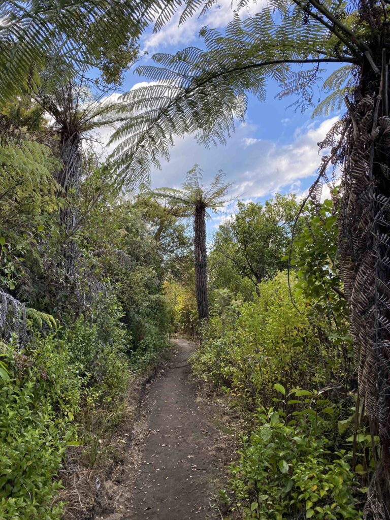
The head of the Te Wairere Falls on Seaview Road marks the beginning of the Kōhi Point section of the trail, which then climbs upwards through ponga trees and native bush. The falls are a sacred landmark and the stream was a vital water source of the Ngāti Awa and Whakatāne township until 1924.
Reaching Kapu-te-Rangi (Pā of Gentle Breezes), there is indeed a welcome breeze after the climb, while the panoramic view takes what remaining breath you have, away. Standing on the site of this historic pā is a highlight of this part of the walkway, the vista stretching from the volcanic peak of Mount Tarawera and out to Whakaari (White Island).
Further along, at the tip of Kōhi Point, Moutohorā Island (Whale Island) and Whakaari punctuate the ocean view stretching out before you.
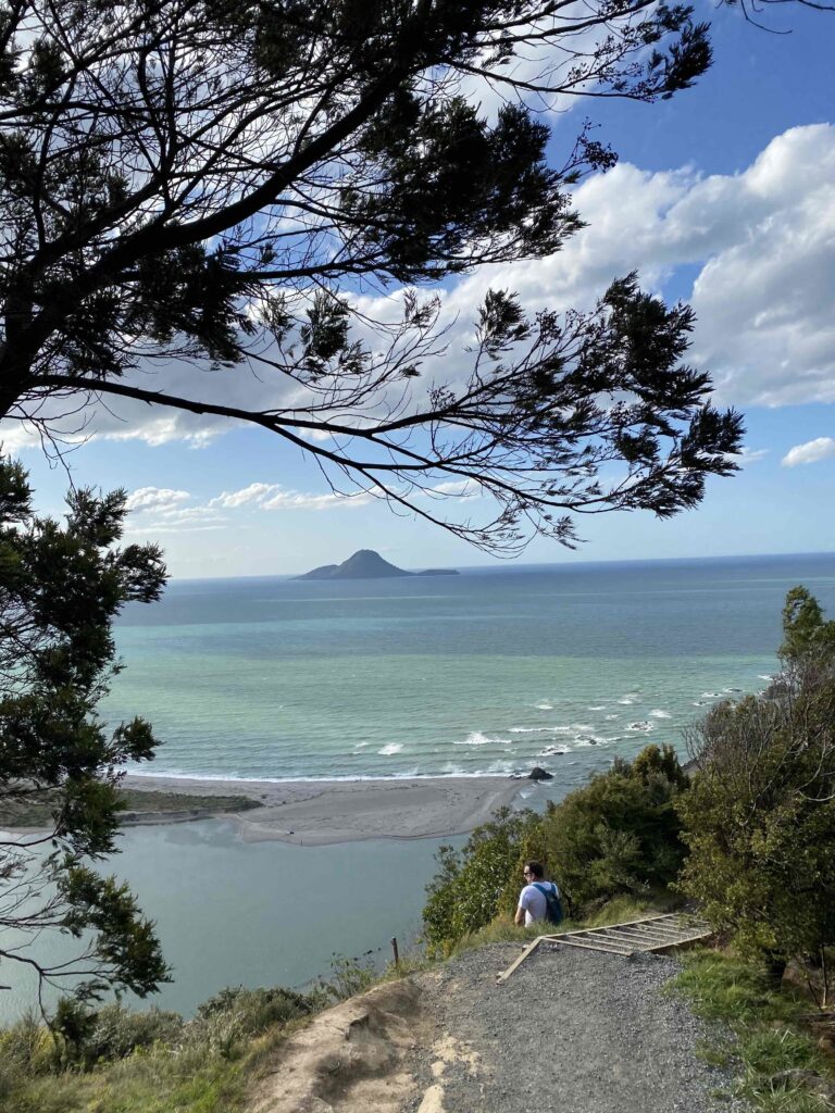
Bird song follows you through the forest until the sound of waves crashing upon the cliffs rises up to meet you. Ensure you check the tides before leaving as the next bit – along Ōtarawairere Bay – can only be walked at low tide. This beautiful secluded beach is perfect for a lunch stop or swim, before heading over the hill to Ōhope’s West End surf beach.
Continuing along the trail from Ōhope and up the Fairbrother Loop Track will take you through the largest remaining pōhutukawa forest in New Zealand.
Distance: 16km circuit (5-7 hours) can be walked in sections.
Walking notes: The Whakatāne to Ōhope section is about 7km (2.5 hours). Take the stairs on Canning Place behind the Whakatāne War Memorial to Kōhi Point Walkway and Seaview Lookout. The track begins on Seaview Rd.